Skip to content

Your Cart (0)

View cart

Your cart is empty

Continue shopping
CALL OUR SALES EXPERTS TODAY: [984-664-9260] Habla Espanol [504-383-7978]

Control Point Corrections TrueRTK

CPC TrueRTK (powered by Point One Navigation) delivers real-time corrections with instant setup, wide coverage, and unmatched reliability—for just $1,500/year.

Start your free 14-day trial today.

  • Signal Tracking: GPS (L1C/A, L2P codeless, L2C, L5), GLONAS (G1, G2), BeiDou (B1-I, B1-C, B2-I, B2a, B2b, B3I), Galileo (E1, E5b, E5a), QZSS (L1 C/A, L2, L5)
  • Data Format: RTCM v3.2 MSM4
  • Latency: <<5s
  • Station Survey Accuracy: H - <0.1 cm; V - <0.1 cm
  • Rover Accuracy: 1-3 cm
  • Powered by Point One TrueRTK

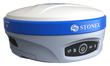
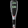
Achieve fast, centimeter-level precision with Control Point Corrections powered by Point One TrueRTK. Built for surveyors and mapping professionals, this real-time correction service offers 1–3 cm horizontal and vertical accuracy across a secure network of over 1,400 reference stations.

TrueRTK delivers immediate fix times and seamless integration with dual-band GNSS receivers or any NTRIP client. You’ll get reliable accuracy in real-world conditions—even in obstructed environments like urban canyons or dense tree cover. With a public base map, you can see exactly where your base station is in relation to your site for better control and accountability.

Whether you’re conducting site surveys, mapping utilities, or laying out construction points, CPC TrueRTK makes high-accuracy positioning accessible and dependable.

  • 1–3 cm Accuracy with Instant Fix Times: CPC’s dense reference network and advanced correction algorithms provide horizontal and vertical accuracy within 1–3 cm—minimizing downtime and keeping crews productive in the field.
  • Seamless Integration: Compatible with any dual-band GNSS receiver or NTRIP client—no new hardware or platform lock-in required.
  • Cost-Effective Operation: By eliminating the need for a dedicated base station, CPC TrueRTK reduces capital investment and long-term maintenance costs.
  • Flexible Applications across Industries: Ideal for topographic and boundary surveys, site layout, utility mapping, grading, and other high-precision tasks across surveying, construction, GIS, agriculture, and infrastructure sectors.
  • Transparent and Accountable: A public coverage map shows reference station locations relative to your jobsite, giving you confidence in correction quality and improving team coordination.
  • Global Coverage: Work seamlessly across the US, UK, EU, South Korea, Australia, New Zealand, and Japan—without the need for local infrastructure or complex setup. With CPC TrueRTK, you get broad correction coverage that travels with you, enabling high-precision workflows in new regions without added operational overhead.
  • Reliable in Challenging Environments: CPC TrueRTK is optimized for the environments where GNSS typically struggles:
    • Urban Canyons – Reduces multipath interference caused by tall structures
    • Dense Tree Cover – Maintains signal lock with a broader satellite array
    • Solar Activity & Atmospheric Interference – Real-time monitoring and network redundancy preserve correction stability

Tiger Supplies offers a 30-day return policy from date of shipment for this product, subject to a 20% restocking fee, in addition to the return shipping charges. The product must be in new condition and in its original packaging. We take the responsibility to make sure this product arrives in a brand new working condition. Should your item arrive damaged, we will take full responsibility and replace the product at no cost to you.

We do not accept returns or cancellations for special ordered items.

For complete details of our return policy and process, please refer to our general return policy page.

  • TrueRTK Live Network Coverage

    Our live map shows real-time coverage across CPC’s global network. Zoom in or enter your ZIP code to find the nearest reference station to your project site.

    Frequently Asked Questions

    What is RTK?

    RTK (Real-Time Kinematics) is a positioning method where a fixed base station sends real-time corrections to a GNSS rover. This removes common signal errors and improves accuracy from meters to centimeters.

    Please note: Performance depends on the accuracy of the base location, the quality of the sky view, and distance to the rover.

    How accurate is RTK?

    RTK provides centimeter-level accuracy. This precision is essential where even minor errors can have major consequences. CPC’s TrueRTK corrections offers fast fix times and consistent accuracy, even in challenging environments.

    What is an RTK base station?

    An RTK base station is a fixed GNSS receiver with a known position. It continuously monitors satellite signals and sends correction data to rovers in real time. CPC’s network includes over 1,400+ stations globally, eliminating the need for you to set up your own base.

    What are some common RTK applications?

    RTK is widely used in surveying, construction layout, mapping utilities, agriculture and robotics.

    What are GPS correction methods?

    There are three main types:

    • RTK: Real-time, base-to-rover corrections with centimeter-level accuracy.
    • PPP: No base required; slower convergence.
    • SSR: Models GNSS errors; requires specialized receivers.
    What is Precision GNSS?

    Precision GNSS uses correction data to reduce positioning errors caused by satellite orbit, clock drift, and atmospheric delays.

    How do RTK corrections work?

    RTK systems use carrier-phase measurements, which are far more precise than standard code-based GNSS. However, they come with ambiguity that must be resolved using advanced math. CPC TrueRTK handles all this complexity behind the scenes, giving you fast, accurate positions without needing to manage the process manually.

    What’s the difference between TrueRTK and NTRIP corrections?

    Both deliver RTK corrections. NTRIP is the industry standard, supported by many devices. TrueRTK, in addition, adds authentication and encryption for better reliability and data security.

    Why choose CPC TrueRTK?

    CPC TrueRTK offers several advantages over standard GNSS:

    • Centimeter-Level Accuracy: Achieve 1–3 cm precision compared to the 1–10 meter drift of standard GNSS.
    • No base station required: Access reliable corrections without the cost and setup of a personal base.
    • Quick Deployment: Connect and start working in minutes—no complex setup or configuration needed.
    • Live Coverage Map: Easily check available service in your area using our public reference station map.
    • Broad Compatibility: Works seamlessly with any dual-band GNSS receiver or NTRIP client.

    Compare products

    {"one"=>"Select 2 or 3 items to compare", "other"=>"{{ count }} of 3 items selected"}

    Select first item to compare

    Select second item to compare

    Select third item to compare

    Compare