Software / Warranties
-
Original price List Price: $12,373.17You Save: $916.53 -7%Original price $12,373.17 - Original price $12,373.17Original price List Price: $12,373.17Current price $11,456.64$11,456.64 - $11,456.64Current price $11,456.64| . /
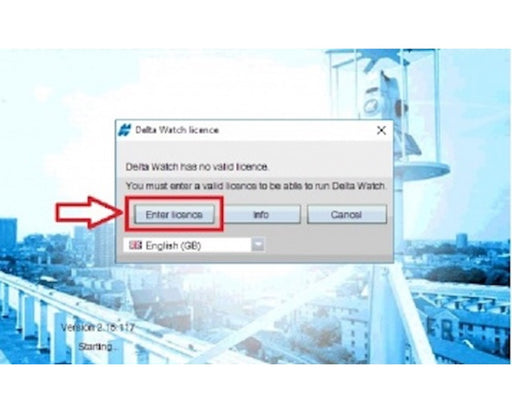
Delta Watch Software License
TopconNo reviews- Designed for total stations & leveling devices
- Allows 1 project & 100 active coordinates
- Hardware dependent & non-transferrable
- Operating system: Windows 7
- Requires 4 GHz Quad-Core I7 processor
- Provides solution for managing data
Original price List Price: $12,373.17You Save: $916.53 -7%Original price $12,373.17 - Original price $12,373.17Original price List Price: $12,373.17Current price $11,456.64$11,456.64 - $11,456.64Current price $11,456.64| . /Save 7% Save % -
Original price $639.00 - Original price $639.00Original price List Price: .$639.00$639.00 - $639.00Current price $639.00| . /
GeoMax 1-Year Additional Warranty for Zoom70/90 Total Stations
GeomaxNo reviewsOriginal price $639.00 - Original price $639.00Original price List Price: .$639.00$639.00 - $639.00Current price $639.00| . / -
Original price $361.80 - Original price $361.80Original price List Price: .$361.80$361.80 - $361.80Current price $361.80| . /
GeoMax 2-Year Extended Warranty for Zone Rotary Lasers
GeomaxNo reviewsOriginal price $361.80 - Original price $361.80Original price List Price: .$361.80$361.80 - $361.80Current price $361.80| . / -
Original price List Price: $469.00You Save: $46.90 -10%Original price $469.00 - Original price $469.00Original price List Price: $469.00Current price $422.10$422.10 - $422.10Current price $422.10| . /
GeoMax Extended Warranty for Zoom Reflectorless Total Stations
GeomaxNo reviews- Choice of warranty & model
- Covers Geomax Zoom40, Zoom25, Zoom50 , Zoom 70 and Zoom 90 series total stations
Original price List Price: $469.00You Save: $46.90 -10%Original price $469.00 - Original price $469.00Original price List Price: $469.00Current price $422.10$422.10 - $422.10Current price $422.10| . /Save 10% Save % -
Original price List Price: $469.00You Save: $46.90 -10%Original price $469.00 - Original price $469.00Original price List Price: $469.00Current price $422.10$422.10 - $422.10Current price $422.10| . /
GeoMax Additional Warranty for Zoom Reflectorless Total Stations
GeomaxNo reviews- Choice of 2 models
- 1-year additional warranty
- Covers the Geomax Zoom40 and Zoom25/50 reflectorless total stations
Original price List Price: $469.00You Save: $46.90 -10%Original price $469.00 - Original price $469.00Original price List Price: $469.00Current price $422.10$422.10 - $422.10Current price $422.10| . /Save 10% Save % -
Original price List Price: $3,928.42You Save: $734.58 -19%Original price $3,928.42 - Original price $3,928.42Original price List Price: $3,928.42Current price $3,193.84$3,193.84 - $3,193.84Current price $3,193.84| . /
Annual Software Maintenance for Delta Link
SokkiaNo reviews- Designed for the Sokkia Delta Link Solution Kit
- Ensures continuous use of Sokkia software
- Provides additional functions to existing software
- Maintenance period: 1 year
Original price List Price: $3,928.42You Save: $734.58 -19%Original price $3,928.42 - Original price $3,928.42Original price List Price: $3,928.42Current price $3,193.84$3,193.84 - $3,193.84Current price $3,193.84| . /Save 19% Save % -
Original price List Price: $455.00You Save: $45.50 -10%Original price $455.00 - Original price $455.00Original price List Price: $455.00Current price $409.50$409.50 - $409.50Current price $409.50| . /
GeoMax 1 Year Additional Warranty for Zenith 35 & 40 Series
GeomaxNo reviews- 1 year additional warranty
- For Zenith 35/40
Original price List Price: $455.00You Save: $45.50 -10%Original price $455.00 - Original price $455.00Original price List Price: $455.00Current price $409.50$409.50 - $409.50Current price $409.50| . /Save 10% Save % -
Original price $22.95 - Original price $22.95Original price List Price: .$22.95$22.95 - $22.95Current price $22.95| . /
Basic Customer Care Package for TS03/07 Total Station
LeicaNo reviews- Recommended for the Leica FlexLine TS03 & TS07 total stations
- 24/7 customer service availability
- Software maintenance & update
- Direct telephone & online customer support
- Professional support & service teams
- Available for 1 to 5-year coverage
Original price $22.95 - Original price $22.95Original price List Price: .$22.95$22.95 - $22.95Current price $22.95| . / -
Original price List Price: $271.00You Save: $27.10 -10%Original price $271.00 - Original price $271.00Original price List Price: $271.00Current price $243.90$243.90 - $243.90Current price $243.90| . /
GeoMax X-Pad Ultimate Survey TPS Software for Zoom Total Stations
GeomaxNo reviews- Compatible w/ Geomax Zoom Total Stations
- Easy to Use & Navigate
- Designed for Professional Surveyors
- Advanced Technology for Property Surveys, Design Surveys & Layout Needs
- Can be installed in Android Devices
- For Data Collection, Integration, and Field Tasks
Original price List Price: $271.00You Save: $27.10 -10%Original price $271.00 - Original price $271.00Original price List Price: $271.00Current price $243.90$243.90 - $243.90Current price $243.90| . /Save 10% Save %
Sort by
